Showing posts with label adventure. Show all posts

Friday 7 September 2012

Travel Time

The Theory of Relativity couldn't have been explained better than this.

Get this.

You may think - a road is a road and distance is distance and that it takes the same time to cover the same distance - no matter which road you're on. But I'll have you reconsider your theory shortly. Let me show you how.
Let's look at some of the popular roads of India:
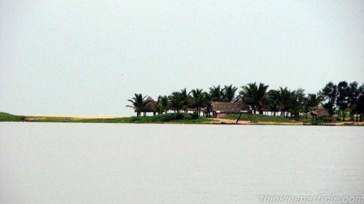
1. Bandra-Worli Sea Link Road - a bypass through the sea.
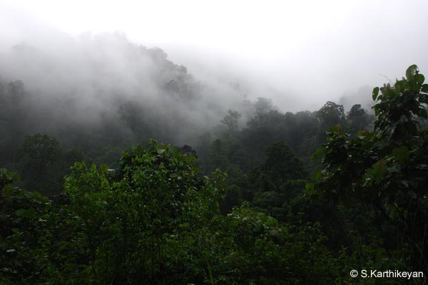
2. Khardong La Road - one of the highest motorable roads in the world.
3. Stilwell Road - once the most expensive road in the world.
4. Grand Trunk Road - one of the oldest roads in the world.
5. Magnetic Hill in Ladakh - one of the strangest roads in the world.
6. Hyderabad-Bangalore Highway - one of the easiest roads in the world.
7. Rohtang Tunnel Road - the longest tunnel-road in India at 10,200 feet elevation.

Geography. Landscape. Weather conditions. Speed limit. Magnetic forces. Unforeseen and uncontrollable forces.  And the driver's disposition towards driving. All contribute to the variation in driving speed and experience.

Now picture this....
1. Bandra-Worli Sea Link is an 8-lane cable-stayed bridge road which is 5.6 kms long and serves as a bypass to the Mahim Causeway, through the sea and is built to reduce travel time by 20 minutes between Bandra and Worli. Though the road may facilitate 60-km drive-speed, the traffic-congestion still brings the vehicles to a grinding halt for more than 15 minutes at both ends. It is one of the best roads in the world and still can't expect to reach on time.

2. Khardong La Road is perched atop a 17,600-feet high mountain in Ladakh, Jammu & Kashmir. Speed is secondary on this road - safety comes first. With all the perennial snow and ice mountains, finding a road beneath the sheets of snow is top priority.

3. Stilwell Road - also called the Ledo Road, was named after U.S. Army General Stilwell and was built during the World War II as an alternative to the Burma Road which was cut by the Japanese Army. In terms of construction costs, this road was once the highest in the world! It's the zigzag that will make you dizzy if you attempt speed on this road.


4. Grand Trunk Road - one of the oldest and longest roads in the world which connects Bangladesh, India, Pakistan and Afghanistan. This route was first initiated during the Mauryan Empire  and was renovated and extended during the 16th Century by Sher Shah Suri of the Muslim Sur Empire who took control of the Mughal Empire in 1540. Now this road would be ideal for high-speeds in most parts of its entire length.


5. Magnetic Hill in Ladakh - thousands of curious tourists visit this area to check this strange behaviour of this mountain/hill which is 27 kms west of Leh in Jammu & Kashmir. Tourists who visited this place at 11,000 feet altitude, have reported that this hilly area has magnetic properties which are strong enough to pull vehicles uphill. If this theory is fake, then why do aircrafts increase their altitude while flying over this area? As it is this hilly landscape is not speed-friendly and then this magnetic force which has a mind of its own?


6. Hyderabad-Bangalore Highway - they say you can drive on this road with your eyes closed. There is some reality to that - though should be attempted literally! This is almost a straight road that runs north to south without any deviations. During the day, you would barely see any traffic on the road. And the highway is 4-track road. You can easily cover this 570-km drive in 7.5 hours during the day in a car as opposed to the 12-hour drive in the night. Well.....I did!


7. Rohtang Tunnel Road - the current longest road tunnel of India which is at 10,200 feet altitude under the Rohtang Mountain Pass in the Pir-Panjal Range of the Himalayas on the Leh-Manali Highway. The tunnel is 8.8 kms in length and is supposed to reduce driving distance of 60 kms between Manali and Keylong.
 

By this theory, you ought to know better than to apply the same formula of distance, time and speed to all geographies alike!
Pix courtesy: Wikipedia, Placeforholidays, Tinsukia.gov.in, team-bhp, walkthroughindia.

Thursday 16 August 2012

Mongmong Festival in Nagaland.


Come September, the extreme eastern state of India – Nagaland would be the perfect place to visit as these agrarian mountain-folk whose lives revolve and depend on agriculture, celebrate the harvest festival – ‘Mongmong’ which in the local ‘Sangtam’ dialect means ‘togetherness forever’. Mongmong is celebrated week-long during the first week of September.

Mongmong Festival celebrates harvest and friendship that has kept these mountain tribes of Nagaland together always. The festival starts off with the village priest (beburu) announcing ‘Zangnyuo Mongmong Nung Eh-Lehe’ or the commencement of the festival with prayers and rituals at midnight.
·        On the first day – which is called ‘Singkithsa’, the oldest person of the area is asked to perform the festival rituals at the well. The villagers spend the day collecting millets, vegetables and firewood from the fields. Livestock (cows, pigs and mithuns) transactions are closed on this day.
·        On the second day, as the gathering of the firewood and the vegetables continues, meat for the festive delicacies is arranged.
·        On the third day which is called ‘MÜSÜYANGTAP’, people worship their three oven stones in belief that these stones represent God (Lijaba). Families eat food only after this worship is done. Local rice beer dancing, tug of war and other merry-making activities take over next.
·        On the fourth day which is called ‘KIKHA-LANGPI’, the Priest and the men-folk spruce up the village by clearing the weeds; clearing the roads and pathways leading to wells and fields and then head to the Priest’s home where a party awaits for all the men who toiled all day in trying to make the village look neat and nice.
·        On the fifth day which is called ‘SHILANG WUBA NYUMONG’, people visit their families and friends in the same village and in the neighbouring villages and exchange drinks and meat as gifts – pretty much like the Muslim custom of ‘Bakrid’.
·        From the sixth day onwards which is called ‘SHILANG WUBA NYUMONG’ the actual harvesting process begins in the fields. People invoke the blessings of God on their crops and their families and pray for a good harvest and good health.

Among a host of others, Nagaland folk songs, Millet harvesting shows, Paddy sowing shows, fire making, tug of war, war dances and archery competitions are showcased during the festivities. Thousands of people from Nagaland, Manipur, Assam, Meghalaya and Arunachal Pradesh converge for the festival during these days.


It is a mélange of colourful cultural displays of 15 different tribes under one roof. Angami, Ao, Chakhesang, Chang, Khiamniungan, Konyak, Lotha, Phom, Pochury, Rengma, Sangtam, Sumi, Yimchunger, Kuki and Zeliang being the largest Naga tribes in Nagaland, converge for this harvest festival Mongmong in Kohima – the State Capital of Nagaland.
Kohima is perched atop a ridge at 4200 feet above sea level (same as Kalimpong in WB) with 70% green cover, and is surrounded by lush green mountains and meadows covered endlessly with emerald hued wild grass and wild flowers. The scenic, serene and fresh environs, the salubrious climate and the lovely sunsets would have you anchored to this place for longer than you scheduled. Kohima is perfect for adventure sports such as mountain-treks; para-gliding; rock-climbing and camping. Mix all this with a cultural fiesta and you’ve got yourself a complete holiday package – the best that your money can buy!

The nearest airport to Kohima is in Dimapur in Nagaland at 74 kms northeast of Kohima. Regular flights from Guwahati in Assam and Imphal in Manipur connect Kohima. The nearest railhead to Kohima is in Dimapur. National Highway 39 connects Kohima to Dimapur on the north and Imphal on the south.
If you can’t make it to Kohima for Mongmong festival during the first week of September, then the next best time to visit Nagaland is during the first week of December for the Hornbill Festival.
Peace Out !

Pix courtesy: the hindu, photoblog.nbcnews, northeasttoday, demotix, govisitnagaland.

Thursday 28 June 2012

Monsoon Tourism in India.

Rains pouring on all your holiday plans? Well…. show them who’s boss! Step outside and brave a little wetness this monsoon. And discover wonder in the wetlands of India.
Pondicherry is Tamil Nadu’s answer to Goa – only quieter, serene and French! Facing the Bay of Bengal on the Coromandel Coast of Tamil Nadu State is the lovely 17th Century French Colony with French Colonial bungalows, Gothic Churches and 45 kms of coastline and beaches. With turquoise-blue waters which are game for sailing, boating, canoeing, kayaking, swimming and fishing, Pondicherry is a fantastic place for sunbathing and beach-treks. Of course that would be a challenge in the monsoons but when it rains, Pondicherry transforms into a gorgeous honeymoon resort - seeming secluded and cozy.
Cuddle up with delicious local sea-food, wine and music on the beach or in one of the numerous beach-resorts and watch the tides and the rains slashing down on endless waves of water. Take off your shoes and drop that umbrella and feel the wet sand slip away from under your feet as you try to leave your footprints on the wet sands of the beach.
Monsoon months: November to January.
Get There: Pondicherry has excellent roads and road-network with National Highways 332, 32 & 66 passing through. It’s a great drive to Pondicherry from anywhere. Chennai Airport is the nearest to Pondicherry and Villupuram is the nearest Railway Junction to Pondicherry.


Where better to see the rain than in a rainforest! And which better rainforest than the Wayanad’s! Climb the Western Ghats to 6890 feet to Lakkidi to experience one of India’s highest degrees of rainfall – it’s overwhelming, incessant and borderline fearful. And this is what rain-buffs rush to Wayanad for during the monsoons -to watch the rain in all its fury!

This is not where you take off your shoes and prance about in the rain. You check-in to a forest-resort and sit on the balcony and watch the rain transform the dense forests into a maze of streams and waterfalls. And when the clouds take a break, quickly hop into a jeep and go explore the aftermath in the breathtakingly picturesque green mountains, valleys, lakes, and meadows on long and winding scenic roads in moist and cool weather. IF the skies clear up, put on your walking shoes and trek through the luxuriant forests of Wayanad to see just how the hill wilderness responds to rain. Don’t jump out of your skin if you feel a trickle of droplets down your spine now and then coz that’s how the tall and wet trees respond to rain-buffs! Take a guide and he’ll ensure you return in one piece as abundance of wildlife is another forte of Wayanad - apart from spices.
Monsoon months: June to September.
Get there: 270 kms from Bangalore by road, Wayanad is easily accessible from Ooty and Mysore. Kozhikode has the nearest international Airport and Railway Station at 100kms from Wayanad.


Not so much an outdoorsy person? Love life’s indulgences? Like to be treated like Royalty in the rain? Check-in to Udaipur’s 17th Century Lake Palace in the middle of the Pichola Lake – hailed as the Venice of the East. Only accessible through royal ferries and boats, the Palace occupies the entire island of 4 acres in the lake and holds mini-ponds and water fountains within. This all-marble Palace has rich, extravagant and Kingly rooms; with ornate and plush interiors; wide arched-balconies; pillared terraces; and the service of the Royal Butlers that will spoil you. Order-in some Rajasthani delicacies and drinks; put your feet up on the velvety futon, and do what Queen Elizabeth, America’s former first lady Jacqueline Kennedy; Viceroy of India – Lord Curzon and Gone with the Wind lead actress – Vivien Leigh did - enjoy. And when it rains, be sure to live in the moment and watch the rain envelope the Palace and shower on the lake. Rated as one of the most romantic destinations of the world, the Udaipur Lake Palace hotel is bound to spice things up for you even in the drenching rain. Feel brave? Step into a royal boat and cruise the lake in the rain and soak up the monsoon ambience of the Lake.
Monsoon months: June to September.
Get there: Within 25 kms radius of the Lake Palace hotel, are the Udaipur Maharana Pratap Airport and Udaipur Railway Station.


Tired of fluttering with the same kind of ‘birds’? Want to hang out with different kind of ‘animals’ for a change? Want to get out this monsoon? Want to push your limits? Want to go where no one’s been? Five problems – one solution - the Eaglenest Wildlife Sanctuary in Arunachal Pradesh. Perched on the Himalayan foothills at 10, 663 feet, is the home of the flagship wildlife – the rare bird – Laughing-thrush and the Asian Elephant, plus more than 454 species of birds; 15 species of animals and 165 species of butterflies. But what makes Eaglenest unique is that unlike the other Wildlife Sanctuaries and National Parks in India which are closed during the monsoons, Eaglenest can be visited during the Monsoons as well. Camp in the wilderness or homestay with the Tibetic tribespeople on the Mountain slopes and play hide and seek with the wildlife in the rain. Else just stay in Tezpur (160 kms) in Assam and visit Eaglenest during the day. Mountain and nature-treks are must-do here even in the rain. At this altitude you’d be wining and dining with source of the rains.
Monsoon months: July to September.
Get there: Arunachal Pradesh may be the tip of the country but is fairly easy to get to. Bomdila in Arunachal Pradesh is the nearest town which connects to Tezpur in Assam.
·         Guwahati > Tezpur > Eaglenest Wildlife Sanctuary – 4 hours (flight between Guwahati & Tezpur and jeep-ride between Tezpur and Eaglenest).
·         Guwahati > Tezpur > Eaglenest Wildlife Sanctuary – 5 hours (bus + jeep)

Pix courtesy: thinkingparticle, indiatravelblog, hammockholidays, greengates, kerala.gov, adventurediva, mattconsidine, brummieandwurzel.blogspot, S karthik, vinchel.

Tuesday 15 May 2012

Amarnathji Yatra 2012.


The toughest Yatra of them all – the Amarnath Yatra – the Hindu Annual Pilgrimage of Lord ‘Shiva Linga’ is here, beckoning all the strong-willed on a spiritual journey all the way up to13,000 feet altitude to the 130-foot high Amarnath Cave where the ice Shiva Linga naturally forms every year. The Amarnath Cave is set amidst snowy Kashmiri mountains where the air loses its oxygen count at -50 Celsius.
Amarnath Yatra is open for 37 days this year between 25 June and 2 August. Registrations – online and over the counter are open. On-spot registrations are also possible.
Visiting the Amarnath Cave is practically an adventure sport in itself as it entails strenuous trekking-trails through challenging rocky, verdant and snowy mountainous terrain and camping in the mountain wilderness. Involving 50 kilometres of near-vertical mountain-climb and spanning 4 days (one way) is this mother-of-all-Yatras for Hindus all over the world.

The base camps for this Yatra are Chandanwari and Baltal. Both these places are approached via Jammu. The routes being:
1.    Jammu > Pahalgam (315 kms from Jammu to Pahalgam) > Chandanwari > Pissu Top > Sheshnag > Panchtarni > Amarnath Cave – 50 kms from Chandanwari to the Holy Cave.
2.    Jammu > Udhampur > Patnitop > Kud > Ramban > Banihal > Qazigund > Anantnag > Srinagar > Baltal (414 kms from Jammu to Baltal) > Amarnath Cave – 14 kms from Baltal to the Holy Cave.

Pilgrims can also complete this Yatra in a shorter span by availing of the Helicopter rides which start at Pahalgam and at Baltal and back. Ponies are another alternative for people who can’t walk or fly in Helicopters.
6, 34,000 people from all over India and the world visited Amarnath Yatra in 2011 – the highest ever!

Jammu & Kashmir Tourism Department along with the Bhole Bhandari Charitable Trust are gearing up for more visitors in 2012. Registration Counters have been increased from 149 to 274 counter and additional tent-accommodation facilities are underway – being freely offered by Jammu & Kashmir Tourism Department, Bhole Bhandari Charitable Trust and many other non-Government Charitable Organizations. Helicopter fare from Pahalgam and Baltal to Amarnath Cave has been slashed by 40% in order to make it more convenient for aged pilgrims who are daring this Yatra these days. Security has been revved up along the route to make it naturally safe for the pilgrims.

The one thing that is reiterated as mandatory by the Shrine Board is a fitness test and a medical certificate issued by Registered Medical Practitioner for the pilgrim, without which, the pilgrim is not allowed on the Yatra as 107 pilgrims lost their lives due to Cardiac arrest on Amarnath Yatra in 2011 and the Shrine Board is concerned for the safety of the pilgrims. So, take this seriously people.
Besides the Darshan of the Shiva Linga in Amarnath Cave, the amazing aspect of this Yatra is the route to the Holy Amarnath Cave which is awesome and overwhelming and gives a sample of the glorious Kashmir terrain. And reciting what my colleague recently taught me - Bol Har Har Mahadev!
Pix courtesy Wikipedia & Amarnathjiyatra.